The Grand Canyon is one of the most spectacular and awe-inspiring places man has ever had the pleasure of viewing. 277 miles long, 18 miles wide, and a mile deep, The Grand Canyon promises to take away the breath of anyone who sets their eyes on it. Most stay on the rims during their visit of the Grand Canyon; very few people take the long and arduous journey to the very river that formed it. This review will account the experience of hiking the South Kaibab Trail down to the bottom of the Canyon, passing through Phantom Ranch, and then going back up the Bright Angel Trail. The route is long, and ridiculously hot if done between the months of May and September. With that being said, if done during the correct conditions, the hike can truly be an incredible experience. Let’s get into it.
The Grand Canyon Experience
Begin by starting at the South Kaibab Trailhead. This trailhead is only accessible by shuttle, or by walking from the nearby Pipe Creek Vista.
The view from Pipe Creek Vista (O’Neill Butte in center.) Photo by John Kowalski.
The trail begins with steep switchbacks cutting directly into the Kaibab Limestone characteristic of the high rims of the canyon. These switchbacks end quickly and the trail continues on, following the side of Pipe Creek. This section of the trail is really quite spectacular, as you get a direct view down into the lower layers of the canyon, some 2000-3000 feet below. These layers are beautiful, being a multitude of whites, pinks, and reds with various different textures and qualities.
After hiking for 0.9 or so miles, you will reach Ooh-Aah point, the first major viewpoint along the South Kaibab Trail. The point, as the name may suggest, makes you “Ooh” and “Aah” at the surrounding canyon. Take a break here, and enjoy the view. When ready, continue onwards, to Cedar Ridge. The trail is cool, following along the top of the ridge, while occasionally dropping to the side every now and then. If fears arise about exposure, not to worry, as the trail is surprisingly wide, coming in at six feet. This is due to the mules that take this and the Bright Angel Trail, carrying riders all the way down to the Colorado.
View from Cedar Ridge. Photo by John Kowalski.
The views from the ridge of the surrounding cliffs are fascinating, as it becomes quickly apparent that the Grand Canyon is much larger than could ever be comprehended by the human mind. Words cannot describe the place; it truly is indescribable.
Cedar Ridge is 1.5 miles down the South Kaibab Trail and is a flat spot located underneath O’Neill Butte. A 300 foot tall chunk of rock, the butte is featured in many photos of the South Kaibab Trail and can be seen prominently from Pipe Creek Vista.
At Cedar Ridge, many turn around, as they feel that they have obtained a “Grand Canyon hiking experience”. This is totally fine and justified considering the elevation gain back to the rim from here is about 1,000 feet. With that being said, this trail description covers the entirety of the South Kaibab Trail and intends to give a detailed guide on getting to the river.
From Cedar Ridge, the trail scoots off to the right side of the ridge, cutting through steep cliffs. These cliffs are incredibly beautiful, and to some degree, deadly due to the steep drop-offs associated with them. The trail stays alongside these cliffs for another 1.5 miles, giving spectacular views the whole way along of eastern grand canyon.
The view at Skeleton Point. Photo by John Kowalski.
At 3.0 miles, the trail reaches Skeleton Point. This is the true turnaround point for most people, and most day hikers will head back up to the rim from here. Again though, this guide continues down the trail to the Colorado River.
Descending down off of Skeleton Point, the terrain completely shifts. What was originally a winding ridge suddenly gets cut off, as the trail desperately tries to dip down onto the Tonto Platform. Copious numbers of switchbacks line the end of the ridge, as the true nature of the Northern half of the South Kaibab Trail is revealed, that of a tedious kind. The constant back and forth notion of the trail is truly an engineering marvel, as the work that was done to create such a well built trail must have truly been back-breaking.
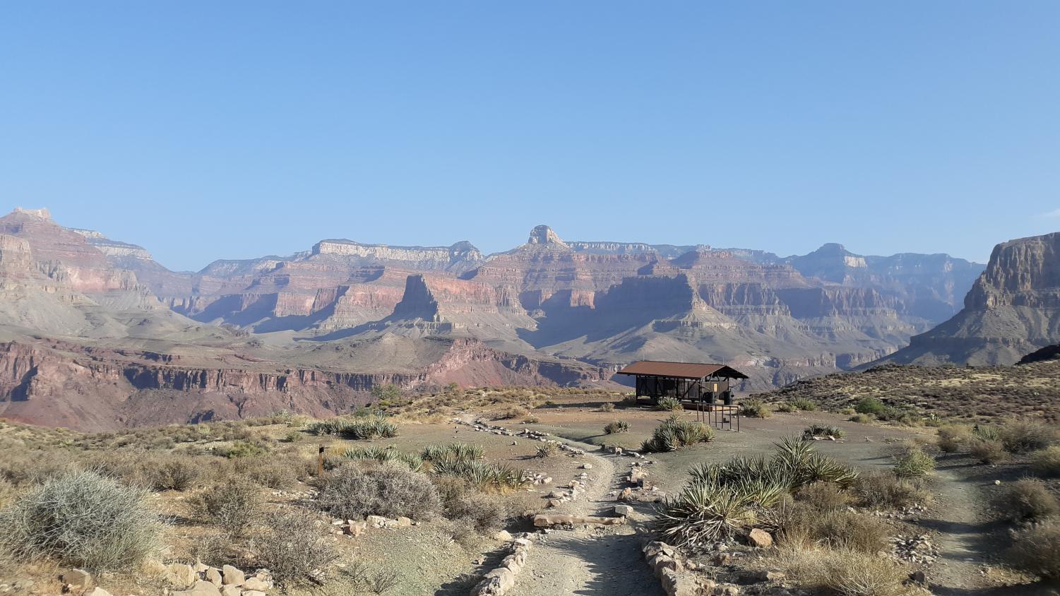
Finally, after traversing the countless switchbacks, the trail takes a turn to the left, making its final journey to the Tonto Platform, where the tip-off lies. This is a final stop before the grueling, 2,000-foot descent to the river far below. Here lies a pit toilet and an emergency phone. This is also where the famous Tonto trail is crossed, a major east-west inner canyon travel path. Here is truly the last major turnaround point, and onwards is the inconceivable mass of the Colorado River. Take a break here, and enjoy the views.
View from the Tip-Off. Photo by John Kowalski.
When ready, start heading down. The river is a long way away.
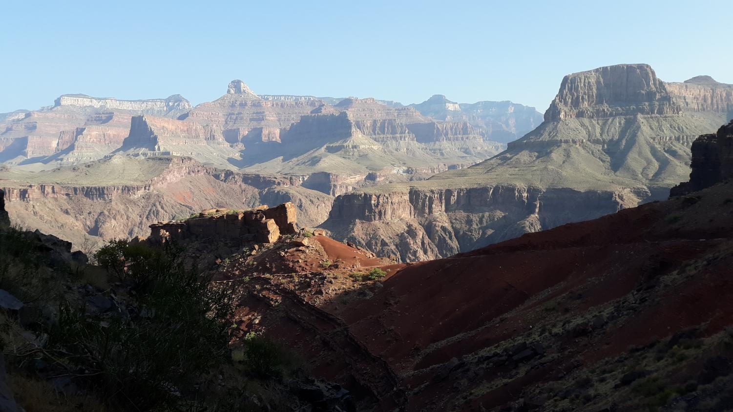
Dropping off of the Tonto Platform, an incredible shift in the colorization and rock type occurs. No longer are bright oranges, reds, and whites seen; instead, a volcanic, tougher type of rock is found, completely changing the canyon’s look. The volcanic rock, being harder and more resistant to erosion, forms a deep inner canyon, which blocks out views of the surrounding peaks and mesas. The few high plateaus visible look far more impressive and imposing, as the steep walls make it appear as if they rise thousands of feet above the river. This, of course, is the case, considering the canyon in places is 6,000 feet deep.
The view from the trail in the inner canyon. Photo by John Kowalski.
The switchbacks resume in full force, as the trail makes it way down through the steep cliffs of the inner canyon. The Colorado is now in full view, as it’s green (or muddy, depending on the season or the weather) waters snake their way back and forth through the deep gorge. After studying the landscape of the Grand Canyon for a while, it could be argued that there is really only one canyon. That canyon is not on the edge of the South Rim though; no no no, in fact the “real” canyon is actually located a few thousand feet below the South Rim. This canyon is, in all actuality, the inner gorge.
The rock of the inner canyon is completely different from the rock found above it, with it being of the volcanic kind in the inner gorge. Meanwhile, above the Tonto Platform, the rock is a variety of whites, oranges, and reds, all typical of the American Southwest. Although this difference can easily be explained away through geologic time, looking from the Tonto Platform at the inner canyon an interesting distinction between the upper and lower sections of the canyon can be made, as it becomes very clear that the Tonto trail uses the Tonto Platform for a reason. It’s flat, just like the rims of the canyon.
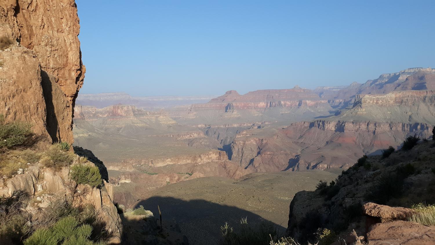
Looking down at the Tonto Platform. Photo by John Kowalski.
Whatever you may make of these observations, it is still nevertheless interesting to see the land drop away from the Platform down to the river, and to be able to look up and downstream and see flat terrain surrounded by tall cliffs and drainages. That’s my theory. Do with it what you will, and understand that none of it is fact; it’s just a thought. Now, back to the guide.
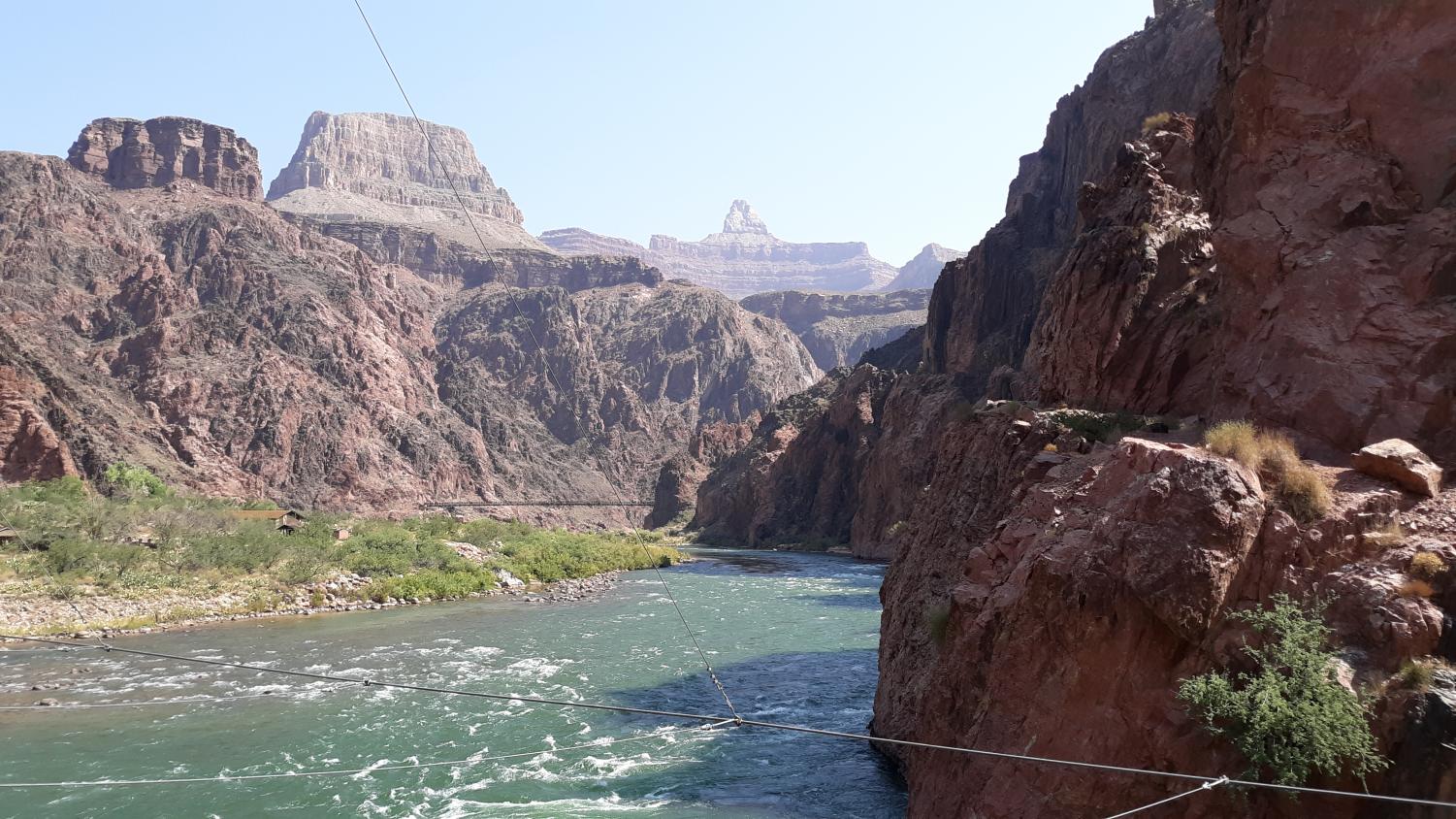
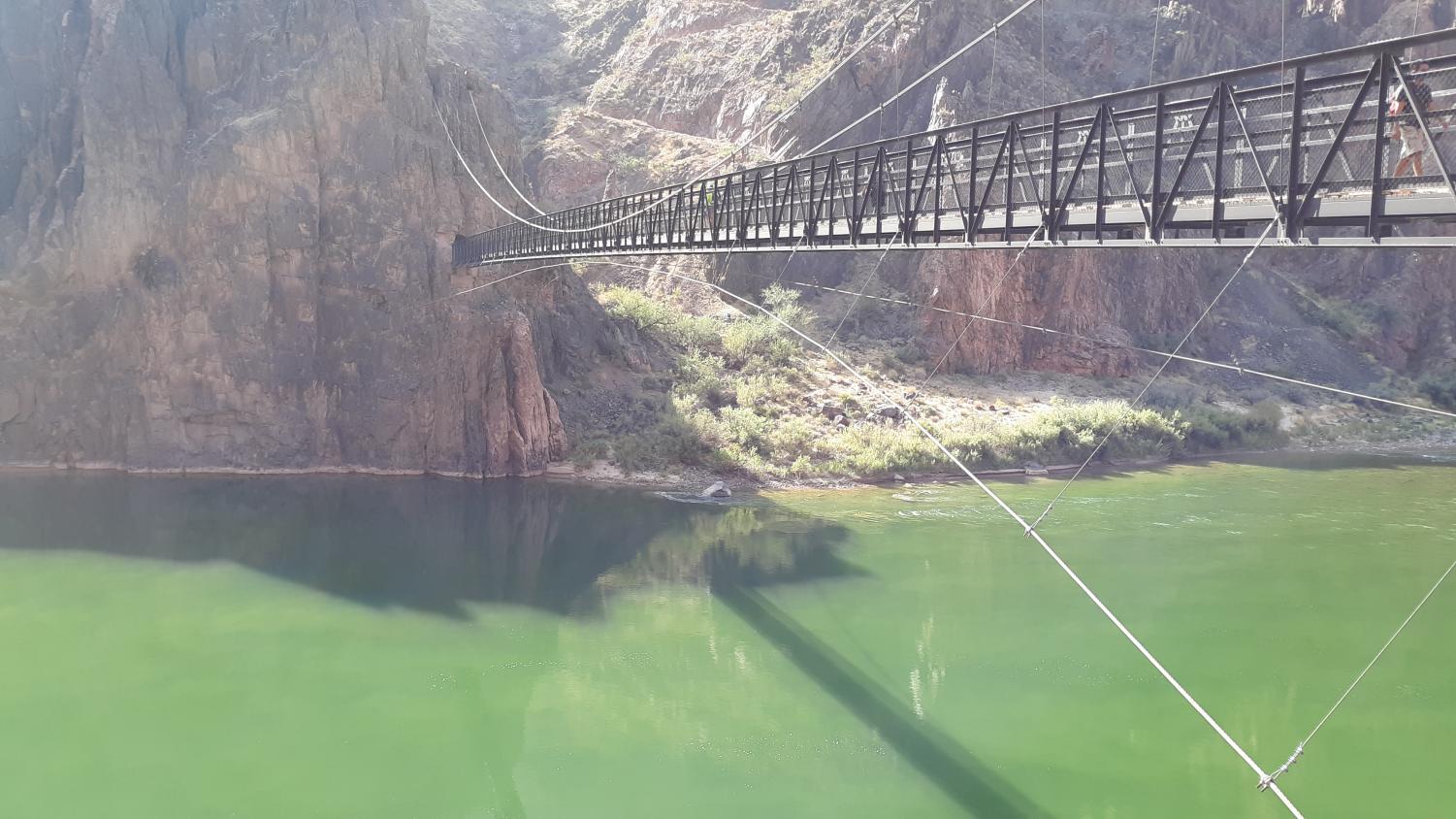
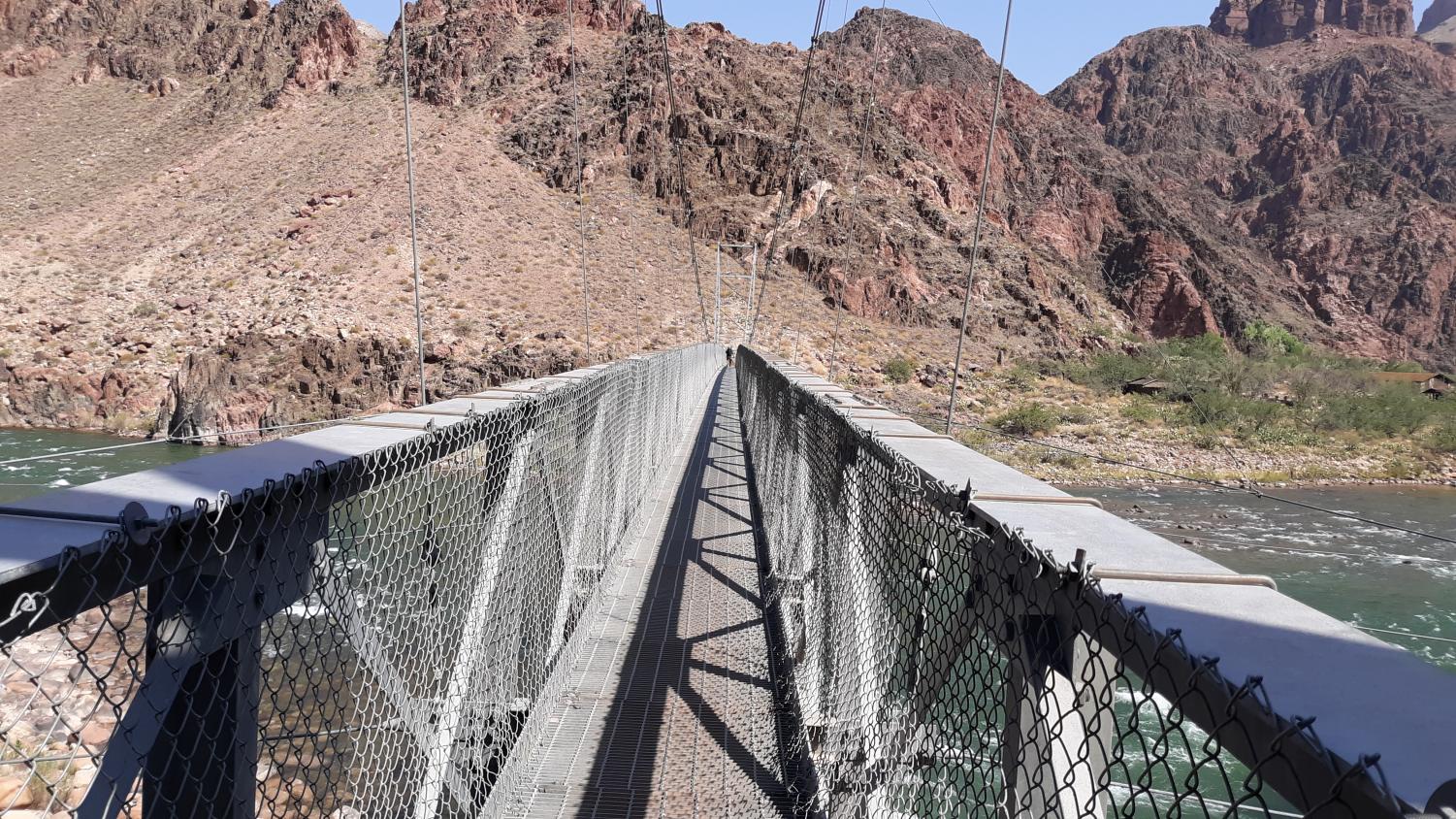
The river is within reach now; after hours of hiking down endless switchbacks, your destination at the bottom of the canyon is almost within reach. The river trail, which is located shortly before the tunnel to the Black Bridge, offers hikers the option of following the cliffs alongside the Colorado. Mules commonly use this trail, as they can’t cross the silver bridge due to its semi-open surface which permits an intense view straight down to the water. Continuing down the South Kaibab, travel down a couple more switchbacks, until you reach a tunnel. This tunnel is the “gateway” to the Black Bridge, one of two bridges to cross the Colorado River in the Grand Canyon. On this hike, you’ll cross both.
Stepping out over the Colorado, the true scale of the river is astounding as it roars along. If you jump up and down on the bridge, it shakes ever so slightly, causing true fear in all who cross it. Look all around; you are at the bottom of the Grand Canyon! Most people will never see the river from its banks here; most can’t really say they’ve been to the bottom of the Grand Canyon.
The Black Bridge, one of only two bridges to cross the inner gorge of the Grand Canyon. Photo by John Kowalski.
To get down to this magical and surreal place, to witness the eons of time frozen in the layers of rock, it truly is incredible. Hike onwards along the banks after crossing the bridge, towards the Bright Angel Trail.
After about a quarter mile, you’ll reach a junction. Behind you lies the South Kaibab Trail, in front lies the Bright Angel Trail, and to the right is the only corridor trail off of the North Rim, that being the North Kaibab. Take the Bright Angel, going towards the silver bridge. The length of such an undertaking might start to undermine the grandeur of being at the bottom of the Grand Canyon, as you may soon realize that you have eight miles and almost 5,000 feet of elevation gain back up to the South Rim. What goes down, must come up.
The Silver Bridge. Photo by John Kowalski.
The Silver Bridge is an impressive sight. The pipeline that gives water to both the South and North Rims and their respective villages crosses the river using this bridge, bringing water from Roaring Springs on the North Rim. After crossing the river for the last time, the Bright Angel Trail follows along the river for two miles, cutting through the vertical cliffs that line the inner canyon. The beauty of such an area cannot be overstated as tall, sandstone monoliths rise high above the Colorado. The Grand Canyon really is spectacular, and yet… an ominous feeling rises in you. Why?
The Bright Angel Trail is two miles longer than the South Kaibab. Those two miles were just spent slogging alongside the Colorado, with no upward elevation being gained. No upward elevation gain. No upward elevation…
Oh God.
Oh dear God.
And it’s still 8 miles.
The Real Grand Canyon Experience
Begin your tedious slog up by refilling your water at the rest stop near the river. This is the last water stop before Havasupai Gardens, so fill up all of your bottles. When ready, start walking.
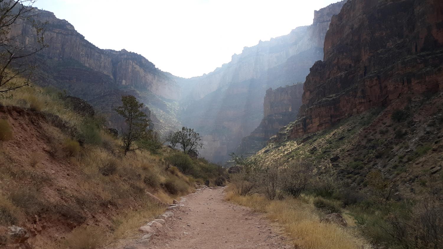
The side canyon that you walk through is beautiful, but the impending pain that is about to follow hangs over your head like a malevolent god, ready to deal out hatred whenever it feels. With this being said, the side canyon is actually quite gorgeous, with the black rock carving a narrow passageway for the trail to follow. The splendor of the place almost makes you forget about the misery, the never-ending heat, and the almost constant chatter of others. These come back in full effect shortly after though, when the Devil’s Corkscrew is reached. This is a section of unrelenting switchbacks that carry the hiker out of the Inner Canyon and onto the Tonto Platform. The name “Devil’s Corkscrew” is in place because of the corkscrew esque formation they create, and the suffering they inflict upon all who walk them.
After the Devil’s Corkscrew, the path traverses alongside the mini canyon, scooting higher and higher until it takes a left and starts heading through another gorge, this one being cut directly into the Tonto Platform. Endless corners and curves are characteristic of this area, with no end to the unrelenting heat bearing down on the hiker. Additionally, the constant sounds of other hikers may cause utter insanity in you, as any semblance of solitude is lost. With all of this being said, Havasupai Gardens is eventually reached. Here is where water bottles can be once again filled up, and where a nice break under the only shade on the entire route can be taken. Fill up, and rest. You still have about four miles and 3,000 feet up, to go.
Looking up at the final slog from Havasupai Gardens. Photo by John Kowalski.
The final section of the Bright Angel Trail is the worst part of the entire hike, no matter what season. Sharp switchbacks go back and forth across the wide canyon, as the heat and overall exhaustion of the excursion finally start to catch up to you. Even so, you continue to push onwards, as the rim slowly becomes closer and closer. At the Three-Mile Resthouse, fill up your water bottles, and take a break. After this, continue the slog up the well-crafted yet nevertheless painful trail. At The One and a Half Mile Resthouse, take a break and fill up your water bottles. Once again, take a break, and then continue up the switchbacks, which are truly the bane of any hiker’s existence.
The view near the rim. Photo by John Kowalski.
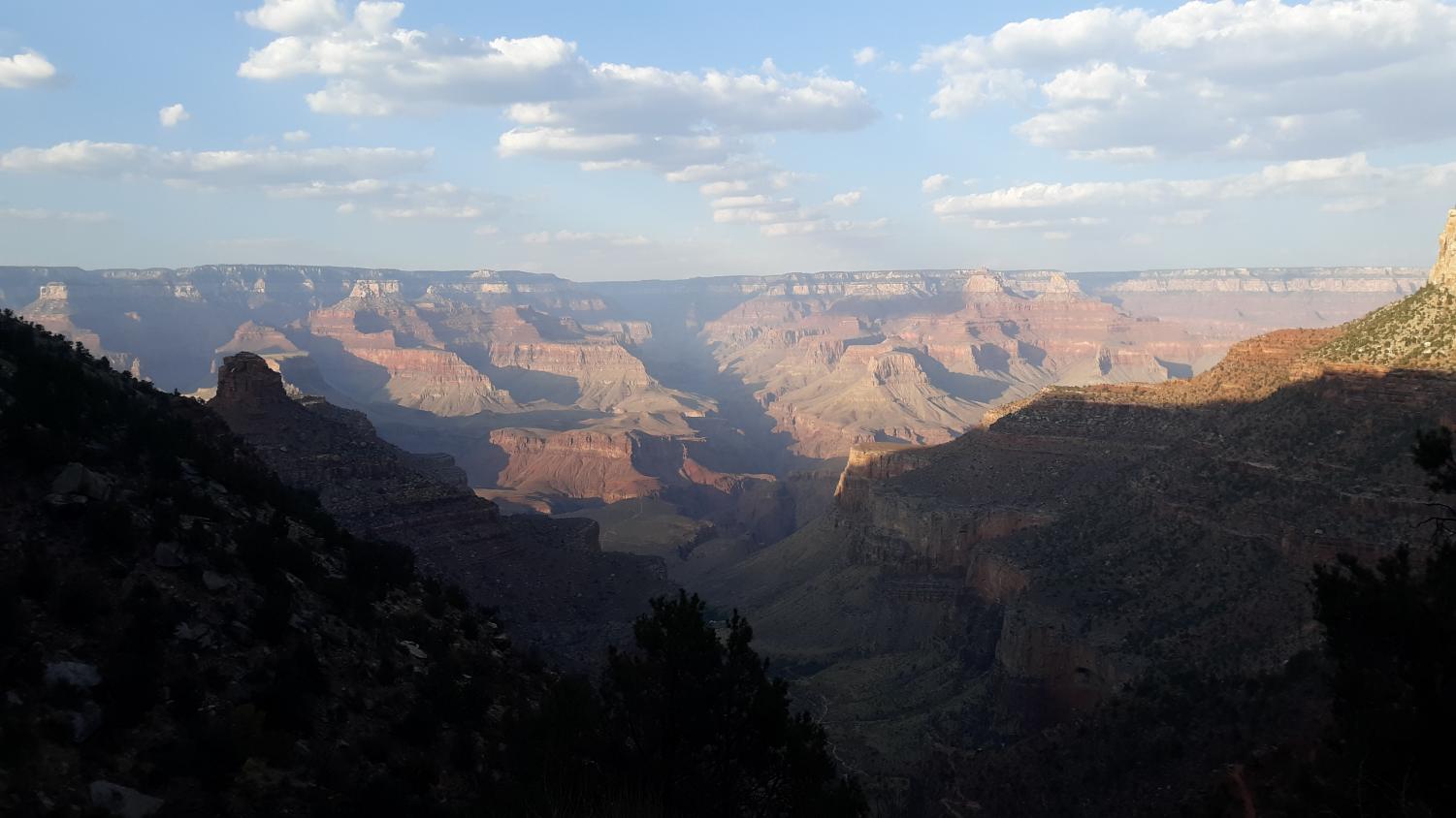
After one and a half miles more, the rim finally comes into view. The relief from reaching the Bright Angel Trailhead cannot be described, as you just want to sit down, sleep, and die. Hop on the free shuttle bus, and take it back to Pipe Creek Vista. You did it. You hiked to the bottom of the Grand Canyon and back. Bravo.
Final Thoughts
This hike is transformative for any who attempt it. In what way, I’m not sure, but it still is either way. Some basic rules when hiking this route:
Carry four liters of water per person. This is necessary due to the heat and length of the trail.
Tell people where you’re going.
Don’t hike alone.
Finally, have an awesome hike! It’s a long and tedious undertaking, but in the end it is most definitely worth it. Cheers.
View Comments (3)
Donate to The Royal Banner
$0
$500
Contributed
Our Goal
Your donation will support the student journalists of Fairview High School - CO. Your contribution will allow us to purchase equipment and cover our annual website hosting costs.
Donate to The Royal Banner
$0
$500
Contributed
Our Goal
Submitting donation...
Thank you for your donation, from all of us at Fairview Publications!
The best and hardest hike l ever done. Took 15 hours but so glad l did it and when l was done all l wanted to do is raise my arms up say l did it and sit down.

Rudy Garza • Jul 5, 2021 at 3:36 PM
The best and hardest hike l ever done. Took 15 hours but so glad l did it and when l was done all l wanted to do is raise my arms up say l did it and sit down.
Alex Ray • Jun 13, 2021 at 2:52 PM
Thanks for the excellent write-up! I’d been thinking about this hike recently and this article popped up at just the right time.
Glenda Feazel • Jun 6, 2021 at 5:20 AM
Enjoyed the hike!