

Green Mountain via First Flatiron Route
The First Flatiron, from the route’s vantage point.
March 29, 2022
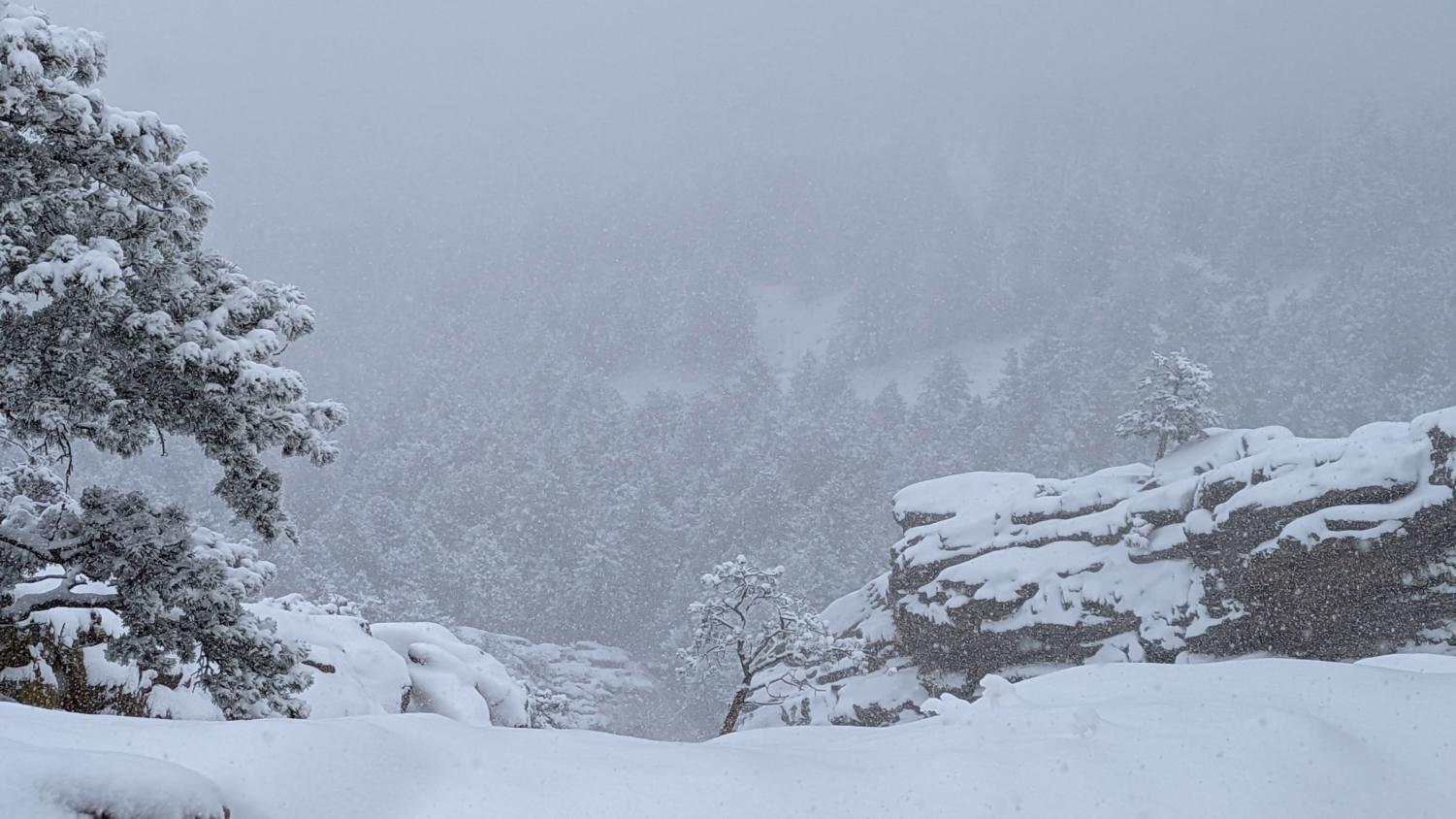
Green Mountain is the third tallest peak located within the vast Boulder Open Space and Mountain Parks Region. Located three thousand feet above the vast prairie plains, Green Mountain is impressive, with the stark jagged cliffs and peaks of the Fountain Formation jutting out above the Precambrian Basement Granite that lies under the peak. Many people traverse the peak every day on different routes, staying on trails cut in between the large swaths of poison ivy that line the mountainside. Of course, many great adventures can be found by heading off the beaten path, with some instead choosing to push their own way through the steep forested slopes, looking for adventure, hope, or a feeling of isolation not provided elsewhere in Boulder. This is one of those routes and is impressive for the vast amounts of scenery covered in its four-and-a-half-mile total distance. If you, reader, are willing to undertake this route, be forewarned: the track is yet another example of a true adventure in the Flatirons, with proper route-finding and extreme precision required to have an enjoyable and pristine experience in the mountainous foothills of Boulder that we so love and desire. With this being stated, let’s begin the adventure.
This route commences at the Gregory Canyon Trailhead. To get to the said trailhead, follow Baseline Road west from its intersection with Broadway. Continue past Chautauqua, before taking a sharp left as the road begins to ascend up Flagstaff Mountain. In winter the trailhead itself is closed; parking is available all along the side of the road before reaching the gated entry point. Simply walk up the road during winter to begin the hike.
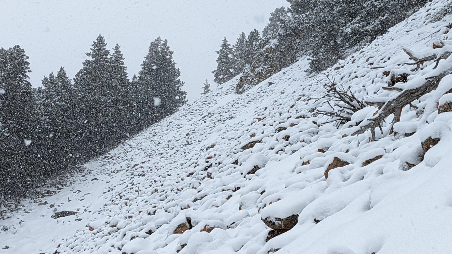
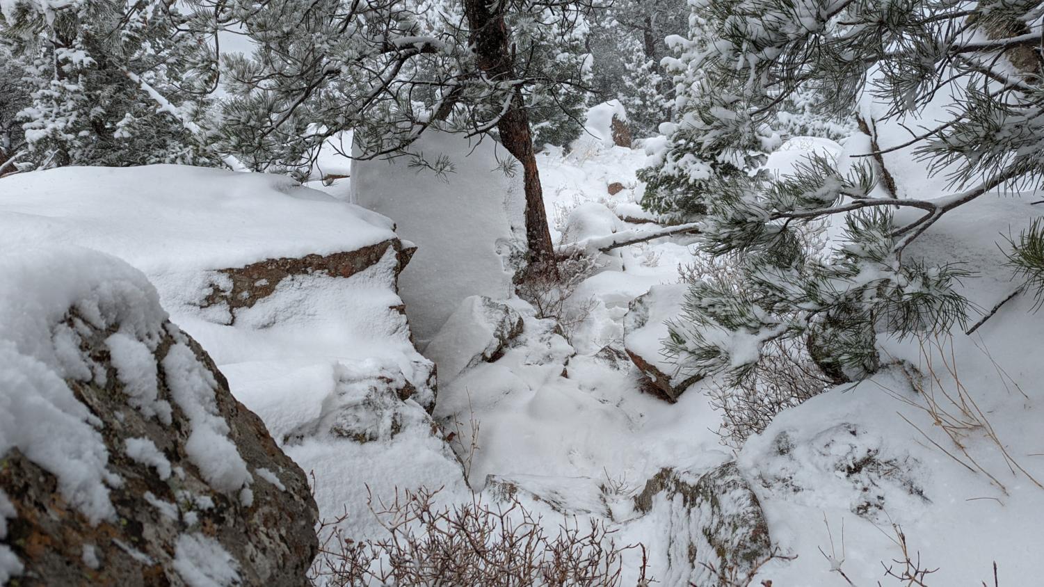
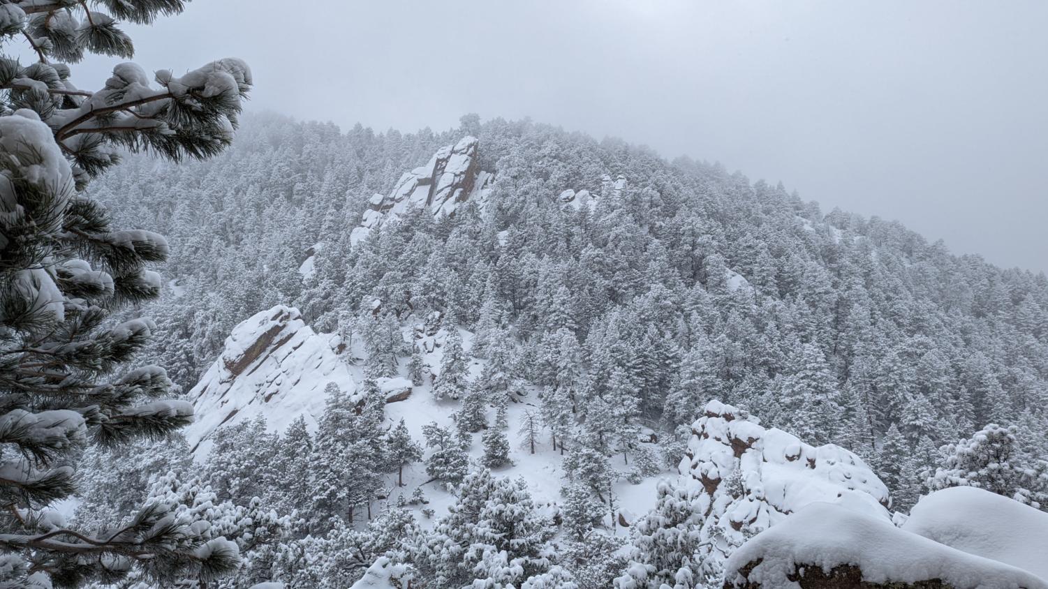
Follow the amphitheater trail, immediately crossing over Gregory Creek on a bridge built after the 2013 floods. Continuing on, the route quickly ascends up towards the First Flatiron, with the debris slopes of the Amphitheater, and a collection of slabs of the Fountain Formation being crossed. After these crossings, the trail levels out before turning right. This is where the route-finding begins and subsequent off-trail travel requires an off-trail permit. Do not fret, it is easy to obtain and can be accessed here. Take a left into the trees, avoiding the copious amounts of poison ivy. Looking forward, a talus slope can be seen through the heavy underbrush. Aim for this slope, occasionally pushing away tree branches that may get in the way. Eventually, a faint path will appear, which will lead you directly to a steep, unforested boulder field. This is where the fun really begins.
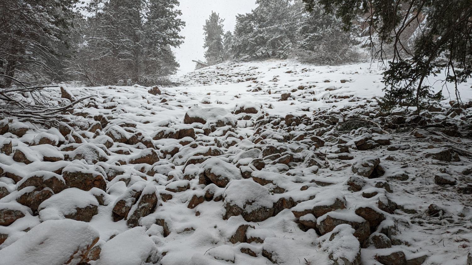
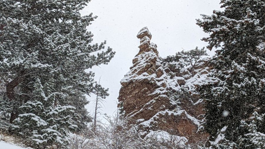
Begin climbing up the steep and somewhat unstable field of rocks, paying careful attention to the slope surrounding you. The rocks that have been deposited here are the direct result of the slow and continuous erosion of the cliffs directly to your right, which is extremely unstable and loose. These conditions have resulted in fascinating formations, notably a tall tower of rock that appears as if it could collapse at any moment. A pinnacle of sandstone, representative of the odd work nature has crafted in its domain.
Careful now, the rocks that you are scrambling over are constantly shifting, creating a dangerous environment for any hiker passing through. One false move and a rock could dislodge and sprain an ankle or worse, break a leg. Make sure every foothold you use is stable; even then, be prepared to move fast to avoid a sliding rock. Climbing upwards past the rock tower, you’ll eventually reach a fallen tree. At this point, a transition occurs in the terrain, notably the way a hiker must traverse the rock field.
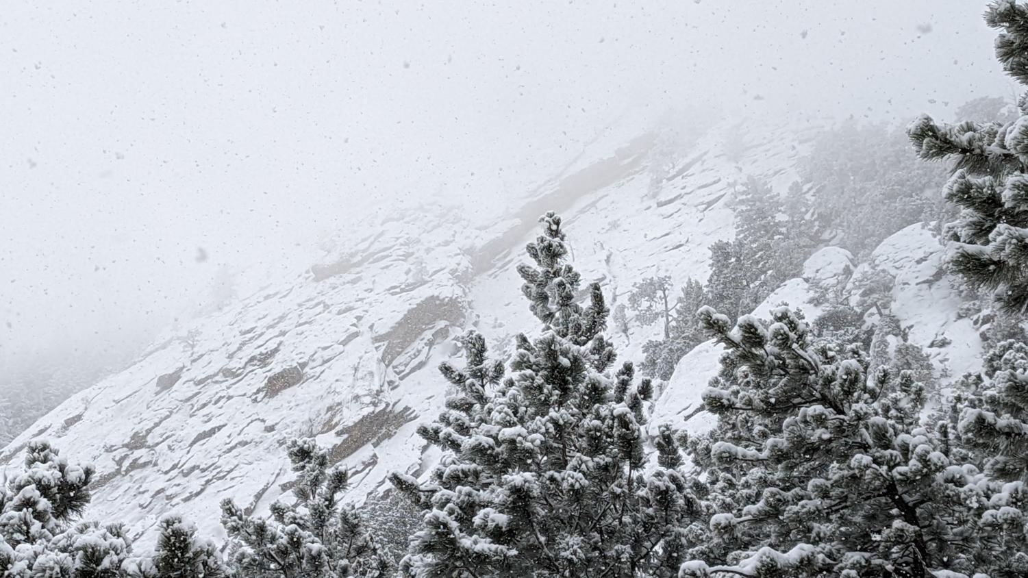
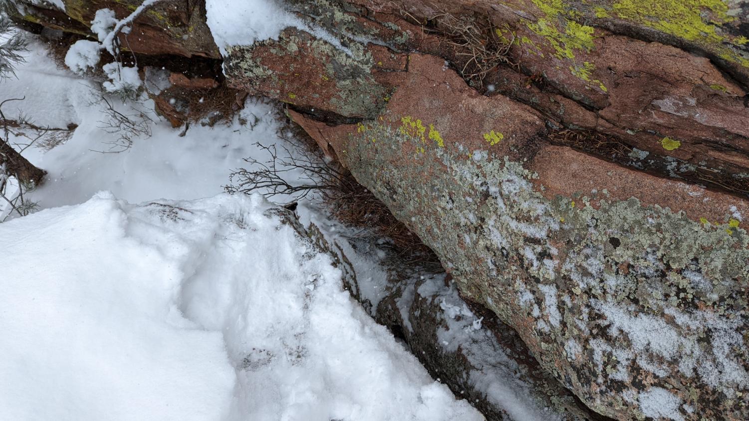
Instead of climbing upwards on a talus-filled slope, you’ll instead be scrambling across a horizontal slope, with the talus slopes falling away 100-200 feet below. Crossing this field, the goal is different now, with the objective instead being to stay as high up as possible, as to not lose any elevation. Continue to be vigilant, as the rocks in this area are still unstable, and can go sliding out beneath you at any moment. Eventually, after traversing for some 30-45 minutes, depending on your speed and luck, the edge of one of the cliffs will be reached. Scampering around this rock ridge, the sedimentary nature of the rock is quickly revealed, with each layer being clearly visible. Also notable is the loose nature of these strata, as small pebbles will crumble off occasionally. This constant erosion is exacerbated by the presence of snow and rain. Stay especially cautious during a winter ascent, as rocks are more likely to fall off the steep ridges above.
After passing this final rock rib, you have exited the most difficult part of the rock field. Simply cross the remainder of the talus, heading south towards the Third Flatiron. Eventually you will intersect a faint path; simply follow this up above the mountains, switchbacking over the top of the steep cliffs which line the rock-strewn basin. Complete a simple class-2 move over a slab, and subsequently connect with the Spy climbing route. This route will take you to a small, tree covered rise of boulders, with the First Flatiron peeking out through the canopy.
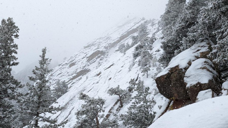
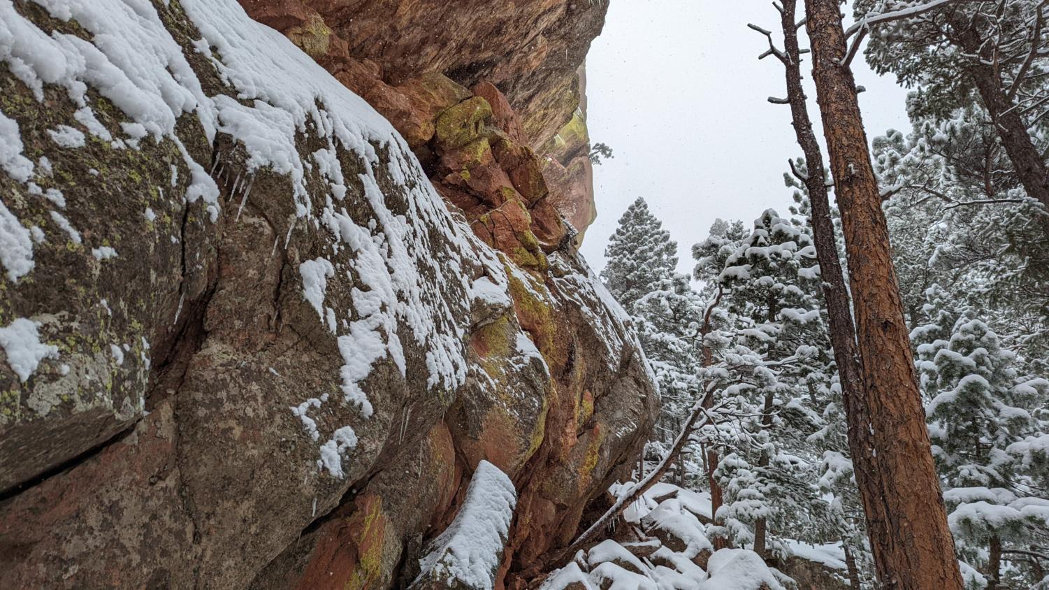
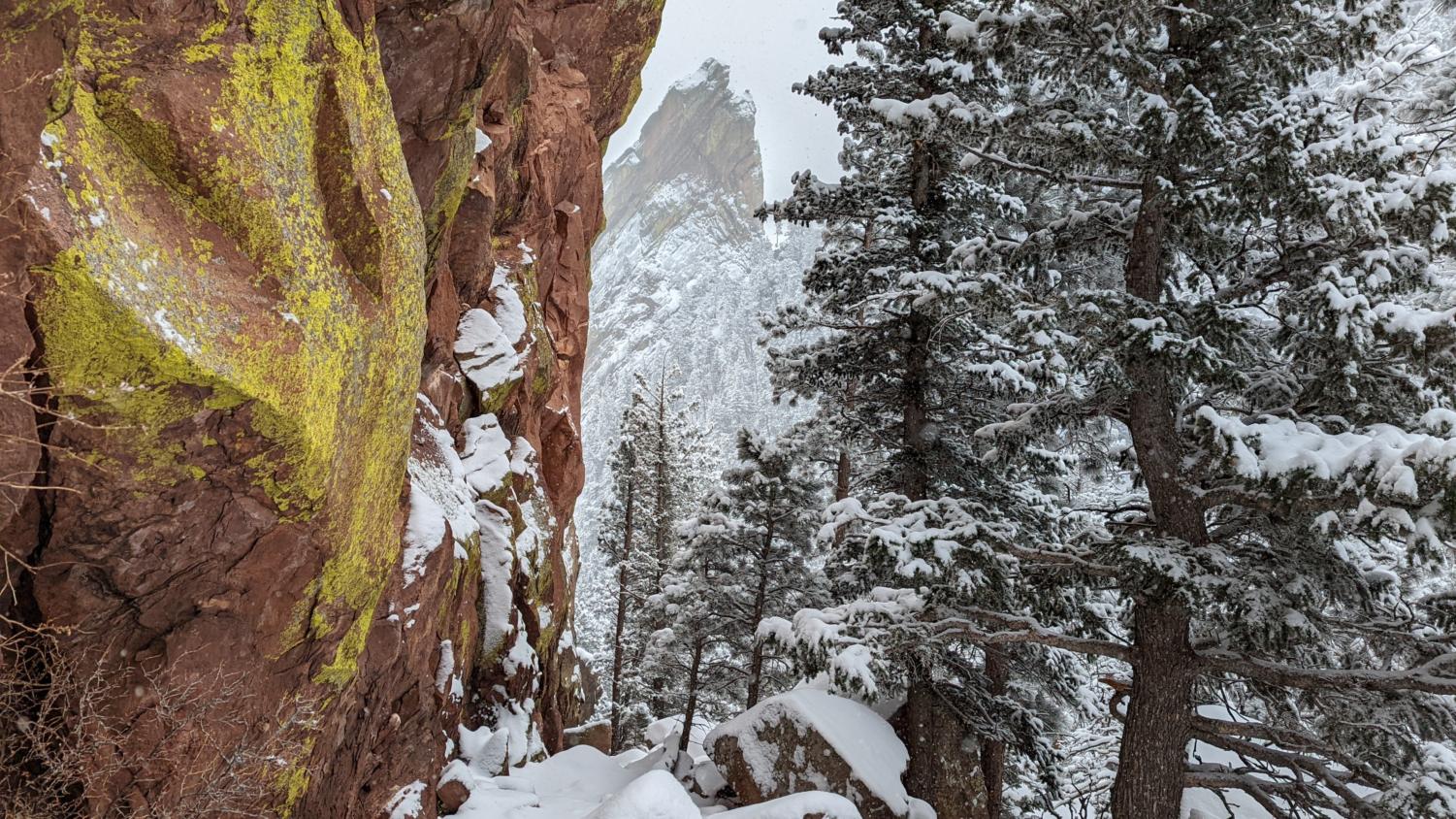
Scramble downwards off of these rocks, descending for a short time before quickly ascending again on varying social paths. These different paths offer access to the First Flatiron for climbers descending its slabby slopes. During the summer climbing season, you may see many parties coming down these trails. Take caution in this locale during winter; the heavily eroded slopes do not offer a stable surface to continue ascending, so extra caution is advised. Aim for the First Flatiron’s rocky north cliff, taking occasional breaks and detours where you feel is necessary or important. Notably, one locale offers a stunning view up the massive slab of Fountain Formation sandstone, deposited and uplifted millions of years ago. Simply scramble in between two massive cliffs of the formation, before popping out at this stunning view (cover photo). When ready, continue onwards; many spectacular views lie ahead.
Climbing onwards, the stunning stratigraphy observed along the Flatiron is clearly visible. Different layers exhibit varying amounts of red tinting, the result of iron oxidation. The fabulous tilting observed is due to the Laramide Orogeny, the event which slowly created the Rocky Mountains. The Fountain Formation as a whole is sitting on a massive bed of Precambrian Bedrock, a formation which notably is exposed in Boulder Canyon, Flagstaff Mountain, and the Indian Peaks Wilderness. All of these locales can be viewed from afar at this point, as your climbing has now brought you up even further along the steep, tree-covered slopes of the First Flatiron.
After a certain amount of time, you’ll reach one of two major difficult sections. A group of rocks, some 5-10 feet tall, block easy access to the upper heights of the route. Looking to your right, you can observe a simple bypass to this problem, a rock to climb. Grab onto a tree at the top of this section, and watch your step; the dirt is loose and could cause you to fall down and sprain your ankle.
Continuing onwards past this section, the crux appears. Slabs, in staircase succession, must be scampered up. In winter, this is a horrid ascent area, notably for the low grip provided by wet sandstone. Trees prove to be incredibly useful, as they allow a handhold in an area lacking such opportunities.
After this steep area is the next major climb, with a small crevasse in the rock that you must climb out of. This is arguably the most difficult part of the route, although the difficulty does not exceed easy class 3.
Congratulations! You’ve made it past the crux section of the route.
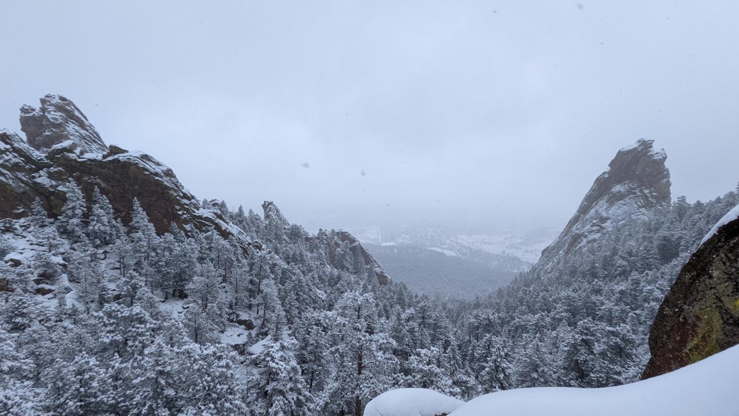
At this point, a notch in the slab is visible. Climb up towards said notch, scrambling up another easy class 2 section. From here, the steep cliffs on the right of you begin to close, forcing any hiker to squeeze through a narrow gap. Subsequently, after this area, the view reveals itself: a massive glimpse down into the abyss, off of the first flatiron. 300-400 feet below lie trees, their tops poking out. Take extreme caution here, as one slip will lead to an untimely and ultimate death. Far away from the Flatirons are large mesas, consisting of alluvium deposited for hundreds of thousands of years. This alluvium built up over time, before being cut down by floods and consistent erosion from the high peaks of the Foothills. The lower ends of Bluebell Canyon, Skunk Canyon, Bear Canyon, and more were all created through this process.
Subsequent erosion also formed the higher canyon walls found in between the Flatirons, revealing the inner Fountain Formation in all of its glory and creating the stark cliffs that form the Skyline of Boulder. After getting your fill of the steep Flatiron front, simply return back, being careful not to trip.
Do not trip.
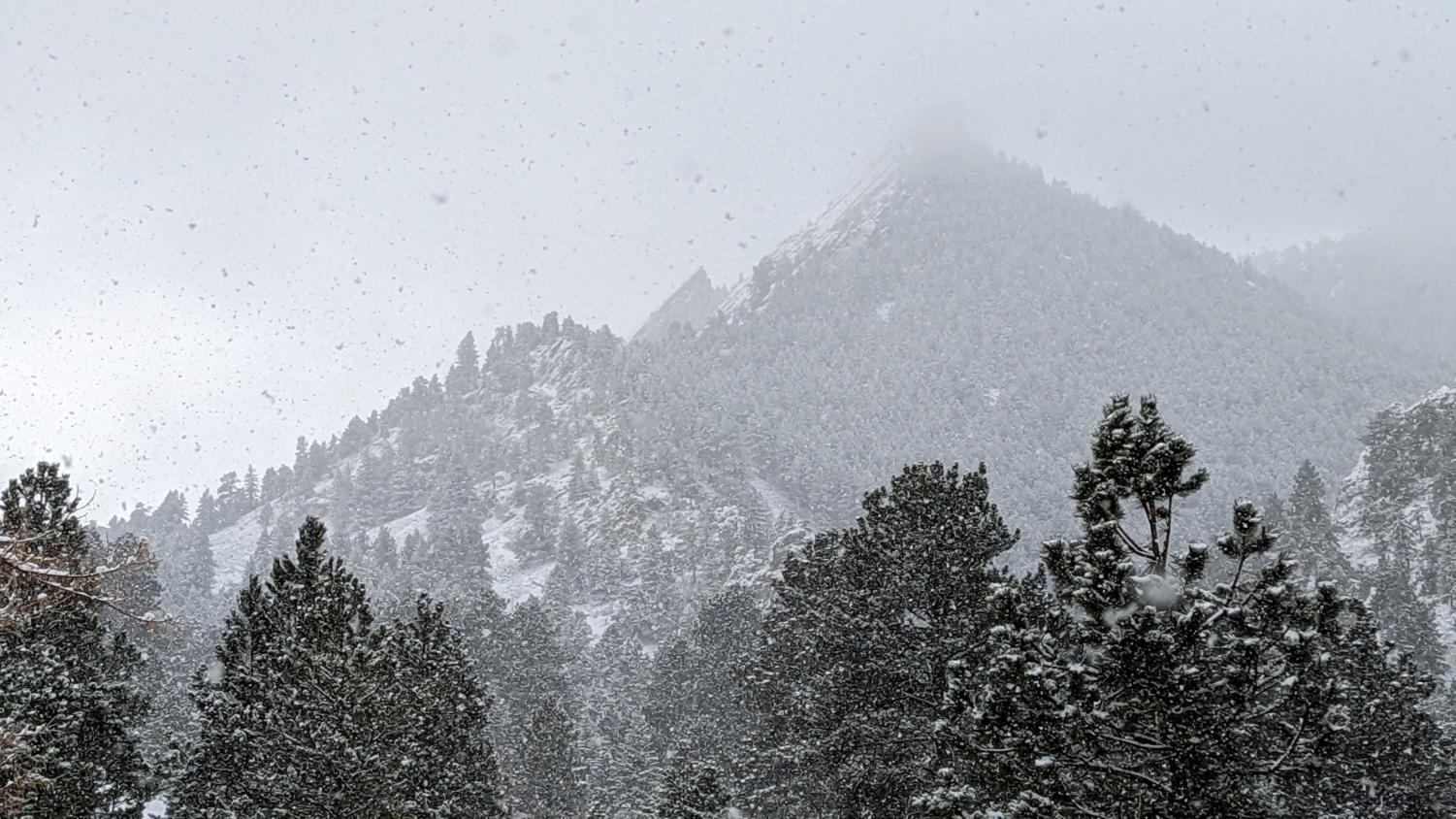
Continuing on up past the abyss view, the jagged northern slope of the First Flatiron grows ever larger. The iron rich sandstone is spectacular, with each and every layer revealing itself to the hiker. Eventually, you’ll make it to the back of the Flatiron, and, if luck allows it, you may even glimpse a climber or two descending off its back ridge. This area offers a wondrous view of the Indian Peaks, with the Precambrian Granite being overlain by stark and beautiful snow, sometimes pouring into the valleys and forming glaciers. Walking westward, stay to the right of a smaller, uplifted chunk of rock. Scramble downwards, taking special care while climbing down the sandstone slopes.
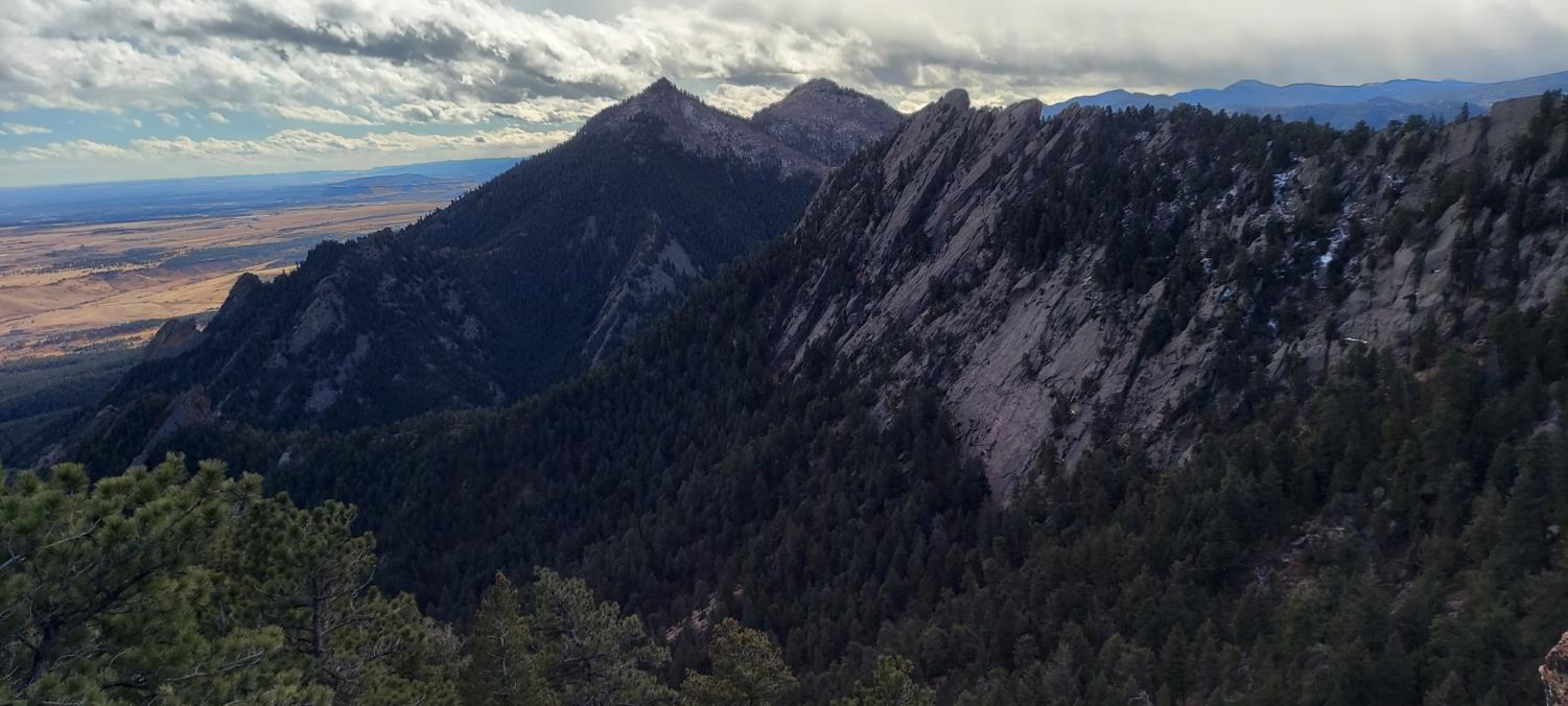
Hiking around to the back of the slab, a glorious view of the Third Flatiron is revealed, with it being framed on one side by the up-tilted Fountain Formation, and on the other side large pine trees.
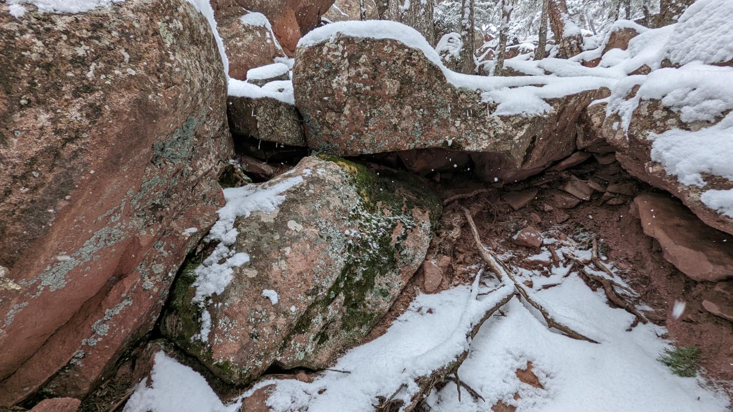
Descend through these pine trees, finding a break in a small, ten to twenty foot wall of sandstone. Once this barrier has been surpassed, you enter a lovely basin, which is a slick rock playground with slabs abounding everywhere and spectacular views of the Third Flatiron being offered. Rest here; the final ascent is at hand.
Make your way to the west, aiming for a sandstone block some fifty to one hundred feet high. Bypass this block on the right, and then hike up and around to its back. Looking down, the land falls away, as both the First, Second, and Third Flatirons are visible, separated by a V-shaped valley, some eight hundred feet deep.
The view is spectacular, to say the least. When ready, head up Green Mountain’s East Ridge, following various social paths through the relatively thick underbrush. Poison ivy is a menace in these areas, with massive groves of the plant being a common occurrence on the slopes. The off-trail permit is required here; follow the link provided previously. Do not fret; this permit is free.
A good while after beginning your ascent, the various social trails will reach a ridge top, and stunning views of the glorious Indian Peaks will appear. The ridge you stand on is partly granite, with many outcrops of the rock appearing. Also intermixed with the granite is some of the Fountain Formation, with beautiful slabs being seen and climbed over. A trail, noticeable at this point, follows Southward along the ridge. Follow this route, hiking in and around many a small outcropping of rock. Eventually, a view of Green Mountain’s summit will appear, followed quickly by the E.M. Greenman Trail. Back on the main route, you can quickly ascend upwards.
During the season in which the raptor closures haven’t affected the Boulder Mountains one, with the proper Off-Trail, can go and access the East Green Mountain Summit. When heading up the E.M. Greenman Trail, take a sharp left at the wooden fence located along the trail. Pass through it; as long as one has a permit, one can go and hike to the outcropping. Scramble along some rocks, an outcropping of both granite and sandstone, and gain a spectacular view of Skunk Canyon, Bear Peak, and South Boulder Peak. Skunk Canyon, some 1,000-1,500 feet deep, is lined by the Fountain Formation and its characteristic slabs. On a clear day, one can see both Longs Peak and Pikes Peak, the two sentinels of the Front Range, marking the respective ends of the mountains, roughly. Bear Peak stands tall and distant, while South Boulder peers ominously over its shoulder. Dinosaur Mountain is also within view, its nature as an extension of Green Mountain becoming apparent. This is one of the most stunning and awe-inspiring perspectives one can have in the Boulder Mountains.
When ready, descend off of the outcroppings of rock, returning to the E.M. Greenman Trail.
Climbing back up towards Green Mountain’s true summit, the plains come into view, slowly growing farther and further from the hiker. A couple switchbacks more, and you’ll find the summit. Scramble on top of the summit boulder, a massive chunk of what appears to be precambrian granite. A summit register exists within a monument of sorts, with a plaque on top identifying the various peaks and summits visible across the massive Tertiary Pediment of Colorado. This flat plain, interjected by canyons of considerable size, eventually terminates at spectacular mountains, these being of the vast Indian Peaks Wilderness. Containing some of Colorado’s last glaciers, these jagged peaks are essentially a simple extension of the nearby Rocky Mountain National Park. Not in name of course, but topographically the two areas are fairly similar, containing massive glacially carved valleys and jagged, granite cliffs, some 2,000 feet tall. All of these sites are visible from the summit of the mountain, including the previously mentioned RMNP, with its similarly carved valleys and peaks. To the left are the twin peaks of Bear and South Boulder, accessible from this summit by a connecting route, some 4 miles long. To the east is the massive expanse of the plains, stretching onwards to the Appalachian mountains. The verticality of the area, to say the least, is impressive.
When ready, descend downwards off the slopes of Green Mountain, following the E.M. Greenman trail as it winds its way through the western ridges and canyons of the mountain. Eventually, one will reach an intersection with the Saddle Rock Trail. Turn right here, onto this trail, descending yet further through the various rock layers. Switchback down the slope, reaching soon enough the Precambrian outcrop of Saddle Rock. To your left is Gregory Canyon; to your right is the ridge you just ascended to reach the summit of the tall and splendid Green Mountain. Walk out onto Saddle Rock if you wish, being careful not to trip on the slippery rock surface.
Do not trip.
When ready, hike downwards, passing by another stunning view of the First Flatiron’s north slope. You can trace the route you took, scrambling along the tree covered slopes underneath the Fountain Formation. In fact, you’re passing through geology as you hike, with the layers slowly growing younger and younger as the trail moves east. Eventually, a ladder will be reached.
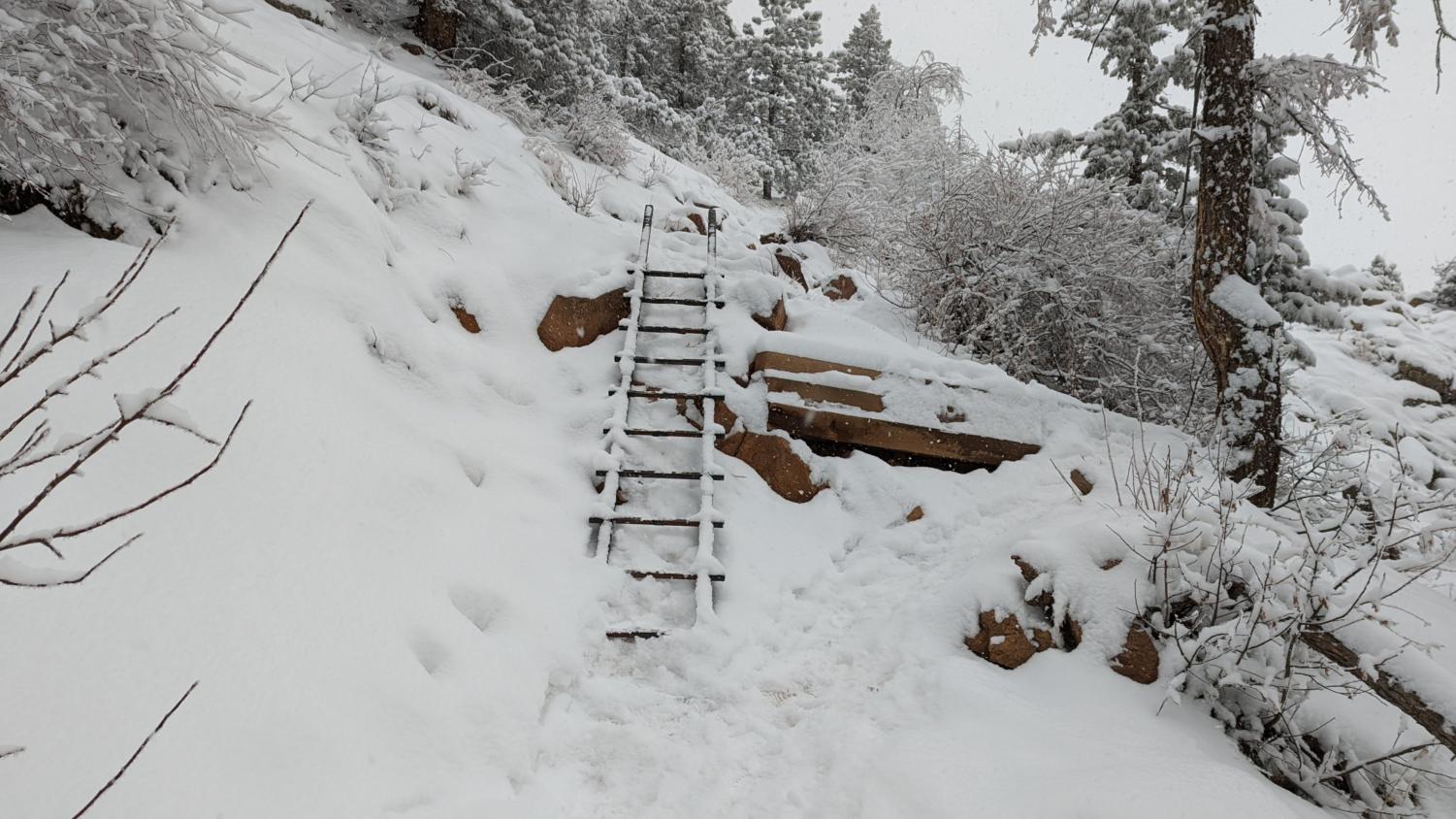
Descend with care, as this ladder, put in place after the 2013 floods, can be slippery in winter. Afterward, move down the trail, passing through more and more of the Fountain Formation, with the summit of Green Mountain growing farther and further with every step you take.
You will reach an intersection. On one side is the Amphitheater Trail, the other the remainder of the Saddle Rock route. Follow the Amphitheater Trail. Spectacular in a sense, this section of the route passes by the amphitheater, the previously mentioned collection of massive slabs known for its rock climbing. Of course, the whole area is known for its rock climbing. Still beautiful though, the trail passes by it, before continuing down past the original left turn into the woods you took at the beginning of this route. Subsequently, this route terminates at its starting point; a full loop has been achieved.
Final Thoughts
Although Green Mountain is only 8,148 feet tall, being the third highest peak in Boulder, the varied terrain available on its glorious slopes is incredible. This route lets you view a good chunk of said terrain, passing through more than a billion years of geologic history, and gaining 2,800 feet or so in its 4.5 mile distance. The deep canyons, stark cliffs, and incredible perspectives offered from said route make it worth traversing, if one is willing to deal with poison ivy and the occasional exposure. Overall, this route is incredible, and is one of the best possible negotiable paths available in the stupendous Open Space and Mountain Parks. Remember to bring plenty of water, Leave No Trace, go hiking with a friend, make sure you have an off-trail permit, and most importantly, enjoy the stunning views offered on said route. Cheers to hiking.